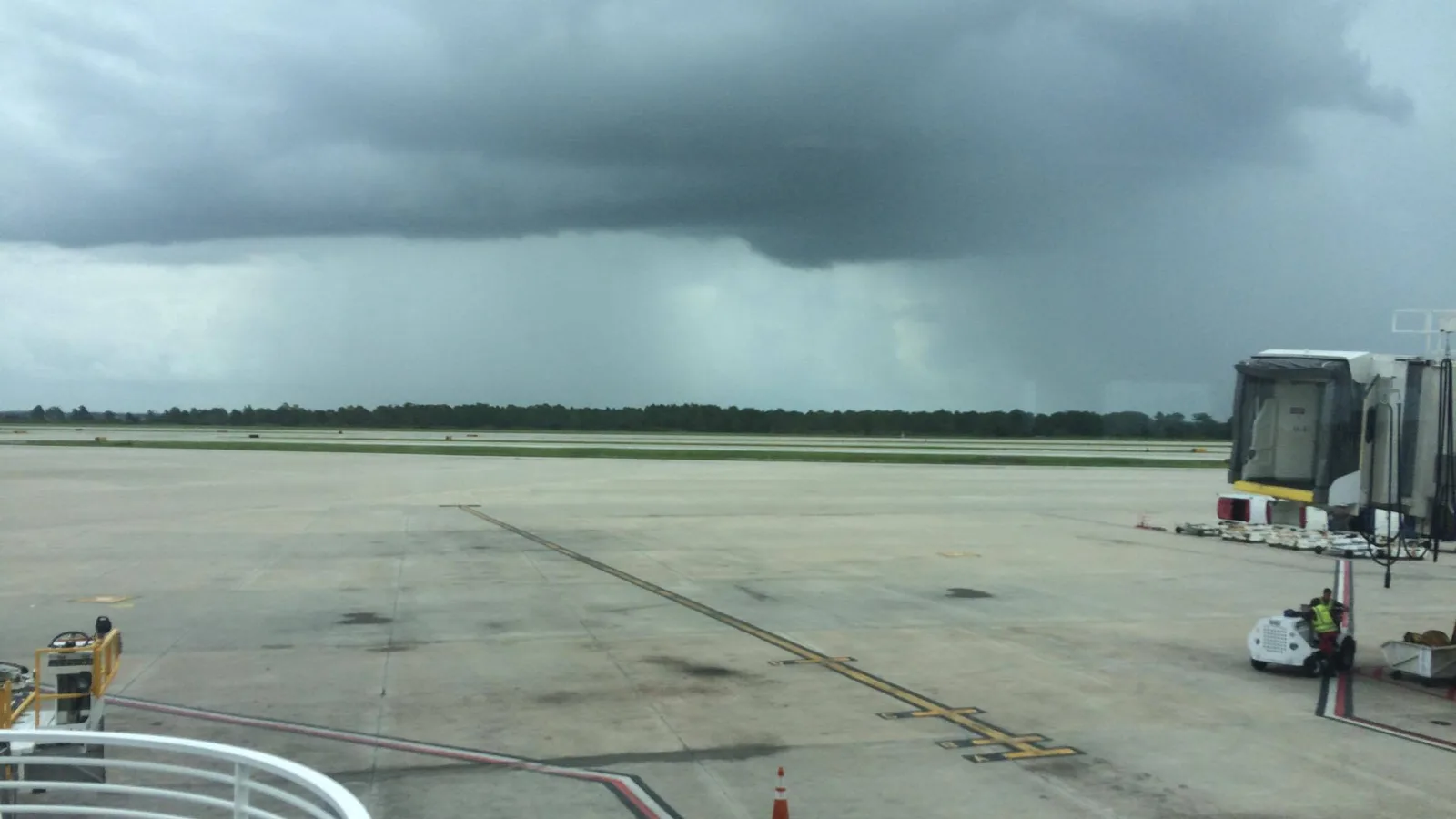
Orlando International logged 2.07 inches Nov. 2, more than double the 1999 record of 0.99 inch. Final weather service totals, the dry year so far and what to do.
Orlando International Airport recorded 2.07 inches of rain on Monday, a record for Nov. 2. The old record was 0.99 inch, set in 1999, the National Weather Service in Melbourne said in its afternoon climate report. The normal for the day is 0.07 inch.
Updated Nov. 4: The weather service’s final climate report for Nov. 2 puts the day’s total at 2.07 inches, up from 2.06 inches at 5 p.m. That leaves November at 2.50 inches through Monday and the year at 33.57 inches, 13.75 inches below normal. The Flood Watch for Orange County expired at 7 p.m. Monday.
Updated Nov. 2, 6:50 p.m.: Orlando’s record daily rainfall added. The Flood Watch for Orange, Osceola, Seminole and Lake counties was set to expire at 7 p.m. The weather service extended its watch through 10 a.m. Tuesday only for the coastal counties and Okeechobee County. Our original report from Monday morning follows the new figures.
Where things stand Monday evening
The weather service reissued the inland watch at 1:37 p.m. It warned that another 1 to 2 inches could cause flooding where heavy rain had already fallen. You can read the afternoon Flood Watch on its alert feed.
The worst flooding was on the coast. Southern Brevard County, about 55 miles southeast, had 16 to 22 inches of rain after midnight, forecasters said in their 2 p.m. forecast discussion. They described widespread flooding from the Melbourne area south to Grant-Valkaria.
For Orlando, the numbers from the airport’s climate report are:
- Monday’s rain: 2.07 inches, final, against a record of 0.99 inch
- November through Nov. 2: 2.50 inches, against a normal of 0.14 inch
- Since Jan. 1: 33.57 inches, still 13.75 inches below the normal of 47.32 inches
Those are the final figures from the weather service’s overnight report for Nov. 2.
Forecasters expect the system to weaken tonight. Scattered showers stay in the forecast for Tuesday, Election Day, with rain chances of 30% to 60%. Drier air arrives from Thursday.
The Monday morning report
Orange County was under a Flood Watch until 7 p.m. Monday. The weather service forecast another 1 to 3 inches of rain across east Central Florida through Monday night.
The weather service issued the watch at 11:09 p.m. Sunday. It covers Orange, Seminole, Osceola, Lake, Volusia and Brevard counties, the Treasure Coast and Okeechobee County. You can read the Flood Watch in full on the weather service’s alert feed.
A watch means flooding is possible. It is not a warning. A Flood Warning or Flash Flood Warning would mean flooding is happening or about to happen.
What the weather service expects
A disturbance is pulling unusually rich moisture over Central Florida and producing bands of heavy rain, the weather service said in the watch. Its forecasters said in their 6:55 a.m. forecast discussion that the bands were reaching into Greater Orlando early Monday.
The weather service forecasts:
- 1 to 3 inches of additional rain across the watch area through tonight
- a 5% to 10% chance of 5 inches or more in some spots
- localized totals of 5 to 7 inches or more where the heaviest bands stall
- flooding in low-lying spots, poor drainage areas and city streets
Forecasters said computer models disagree on how quickly the threat ends this afternoon. That is why they kept the watch running until 7 p.m. They expect less rain later today and tonight, though heavy downpours are still possible overnight.
The ground is wettest south and east of Orlando. The weather service’s soil model shows more than 80% saturation from Brevard County south, and 90% to 95% from the Treasure Coast to Okeechobee. The same system caused flash flooding near Okeechobee and West Palm Beach on Sunday, forecasters said.
The Orlando forecast
The weather service forecast for Orlando, updated at 10:14 a.m. Monday, calls for:
| When | Forecast | Chance of rain | New rain possible |
|---|---|---|---|
| Monday | Showers and thunderstorms, high near 80, gusts to 25 mph | 90% | 0.5 to 0.75 inch |
| Monday night | Chance of showers and storms, low around 71 | 50% | 0.1 to 0.25 inch |
| Tuesday | Chance of showers and storms, high near 83 | 50% | 0.1 to 0.25 inch |
| Wednesday | Chance of showers and storms, high near 84 | 50% | Not given |
Rain chances drop through the middle and end of the week, the weather service said. Forecasters see a stronger cold front reaching Florida around next Monday, Nov. 9, though the models still differ on its timing.
Roads
Florida’s 511 traffic service listed one flooding closure in Orange County on Monday morning. The off-ramp from westbound State Road 414 to U.S. 441 was closed for flooding from about 8 a.m., with the right shoulder blocked. FL511 gave no reopening time as of its 10:38 a.m. update.
FL511 also listed at least eight crashes on Interstate 4, State Road 408, State Road 429 and Florida’s Turnpike in Orange County between about 7 a.m. and 11 a.m. It did not give a cause for any of them.
In Brevard County, about 55 miles southeast, the weather service logged flooded roads in Melbourne, West Melbourne and Palm Bay on Monday morning. A trained spotter reported two vehicles stalled in water in Palm Bay.
Neither the city of Orlando nor Orange County had posted a flooding notice on its newsroom by late Monday morning.
A wet day in a dry year
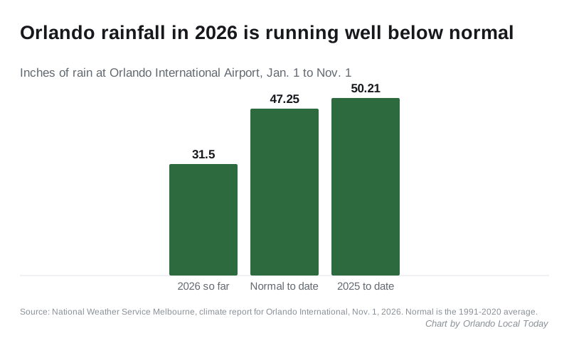
Orlando has had far less rain than usual this year. The weather service’s climate report for Orlando International Airport showed 31.50 inches from Jan. 1 through Sunday. The 1991-2020 normal to that date is 47.25 inches, so the city was 15.75 inches short before Monday’s rain. By the same date last year, the airport had recorded 50.21 inches.
The airport recorded 0.43 inch of rain on Sunday, Nov. 1. The normal for that day is 0.07 inch.
What it means for you
- Do not drive into water on the road. “Turn around, don’t drown when encountering flooded roadways,” the weather service said. You cannot tell how deep the water is or whether the road under it has washed out.
- Allow extra time tonight and Tuesday. Check FL511 before you set off, especially on I-4, State Road 408 and State Road 414.
- Watch for a warning. If you live on a flood-prone street, the weather service asked you to be ready to act if a warning is issued. Alerts for Orange County are on the weather service’s Melbourne page.
- Heading to the beach? The weather service warned of 5- to 7-foot breakers and life-threatening rip currents on the coast today. “Do not enter the ocean!” it said.
- Tuesday is Election Day. The forecast gives a 50% chance of showers and storms. Polls close at 7 p.m. Our voting guide has polling place details.
The weather service’s flood safety page explains what to do before, during and after a flood. For trash pickup during bad weather, see our trash and recycling guide.
We will add the final Monday total when the weather service publishes it.
Have your say